April 8, 2013

Day 5 - Durant, MS

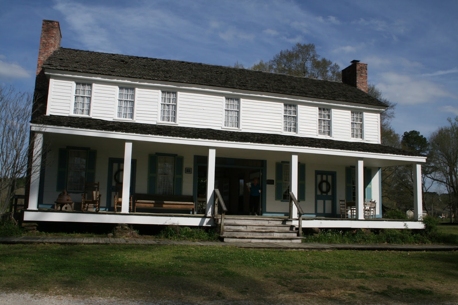
We found Heritage Acres RV Park in our campground directory.  The directory's rating and reality are often quite different.  This selection was a pleasant surprise.  It looked very plain when we pulled in ... access roads and spaces were all gravel.  They had no grass, trees or shrubbery.  But ... it had great utilities and the nicest rest rooms and showers we've ever seen!
Site #46 - Heritage Acres RV Park

We headed back to "The Trace" at 10:15am and spent the day driving south, enjoying its many views.  We ended the day 225 miles later at the Holmes County State Park just outside Durant, MS.

The Trace
The National Park Service does a wonderful job of maintaining the parkway.  The road is smooth and well marked.  Grass berms are groomed and litter free.  Historic points of interest are frequent and described nicely in brochures and signage.

We traveled 155 miles on "The Trace" today.  Highlights include: the John Coffee Memorial Bridge, Pharr Mounds, Dogwood Valley, Chickasaw Council House, Bynum Mounds and French Camp.
John Coffee Memorial Bridge
The Parkway's longest bridge crosses
the Tennessee River - milepost 328.6
3 of 8 Pharr Mounds - milepost 286.7
Wild flowers at Pharr Mounds
Carol can't find any dogwoods in bloom
in Dogwood Valley - milepost 275.2
But there are plenty in bloom along the road
It was in this area - milepost 251.1
Wildflowers at Chickasaw Council House
Controlled burn south of the
Chickasaw Council House
1 of 2 Bynum Mounds - milepost 232.4

French Camp - milepost 180.7
Our last stop on "The Trace" today was a special treat.  French Camp was founded around 1810 when Louis LeFleur and his family opened a tavern and inn.  Today, the French Camp Academy provides help for young students with troubled lives.  The academy students work in the French Camp Historic District.
Huffman Log Cabin (circa 1840)
Carriage House
Holds the 1800' carriage of Greenwood LeFleur
James Drane Farmhouse (circa 1848)
Upstairs room in
James Drane Farmhouse
Old French Camp Post Office
Out building - possibly used for storage
Out building - possibly used for crafts
or slave quarters
Blacksmith Shop
Barn and antique tools
This used to be a tractor or, this is a used tractor
(Fred Hitzhusen may be interested) 
Alumni Museum (circa 1855)
French Camp Bed and Breakfast Inn
(circa 1820)

Camping options right on "The Trace" are pretty limited.  We chose to leave the Parkway and try a campground near Durant, MS.  We're at Site #12 in the Holmes County State Park campground.  It's great ... large sites have concrete pads, water and electric service, a picnic table and a grill.  They have showers and a dump site.  The campground is deep in a forest, at least 2 miles from the nearest highway.  All for $13/night.

April 7, 2013

Day 4 - Tuscumbia, AL

The morning temperature was in the mid-60s.  It was overcast.  There was a light breeze.  We were on the road by 10:45.

We traveled 262 miles through three states and ended the day at Heritage Acres RV Park in Tuscumbia. The route:  I-65S from Horse Cave, KY through Nashville to TN-96, TN-96W through Franklin to Natchez Trace Parkway, south on the parkway through TN and into AL to the AL-20 exit, east on AL-20 through Florence to Muscle Shoals, then to Tuscumbia.

The day cleared and the temperature rose to the mid-70s by the time we got to Nashville.

We stepped into a delightful world when we entered the beginning of the 443 mile Natchez Trace Parkway.  It provided the perfect setting for a Sunday afternoon drive ...  2-lane road, limited access, no commercial vehicles, no traffic lights, no advertising, and no services.  It was so serene!
The parkway runs through the southern Appalachian 

foothills of TN to the bluffs of the lower Mississippi River
Mile markers help connect maps
with brochure highlights
War of 1812 Memorial - milepost  426.3
Gordon House is one of the few structures
from the old Trace.
Gordon House - milepost 407.7
The parkway follows the old Trace.
The Meriwether Lewis Site is at milepost 385.9.
Meriwether Lewis Monument
Reconstruction of old log inn where
Meriwether Lewis died in 1809.

We arrived at the campground around 6:30pm.  We'll return to the parkway tomorrow and continue on south.

April 6, 2013

Day 3 - Horse Cave, KY (Day 2)

We heard the first rooster crow at 6:30am.  Thankfully, the donkey seems to still be asleep.

We had a leisurely wake up, Dick visited with a neighboring camper, Carol worked in the trailer and we had a late breakfast.

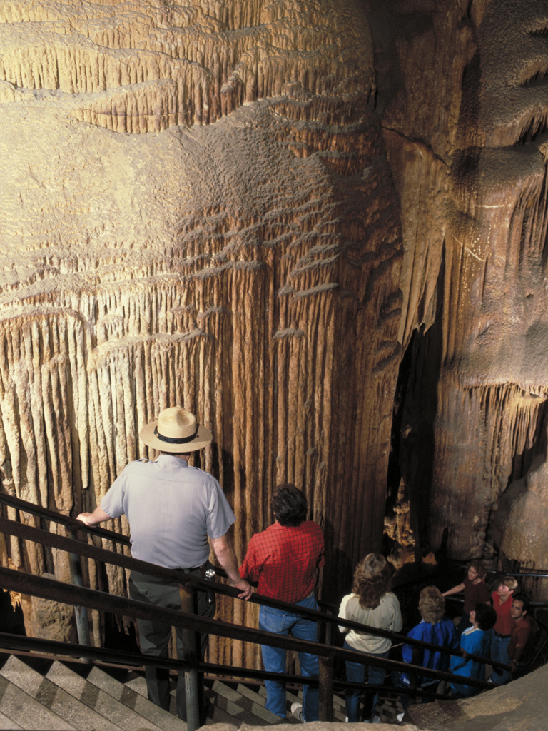
We headed for Mammoth Cave after noon and took the Historic Tour.  This ranger led, introductory tour took us underground for 2 hours, traveled 2 miles and descended to 314 feet below the surface.  It was quite a workout of climbing, squeezing and bending.

We expected the parking lot would be packed full, like yesterday.  We arrived early and easily found a parking place.  Then the light bulb went on ... Louisville is playing in an NCAA Final Four basketball game this afternoon.  Duh!

The park offers many tour options.  The Historic Tour was a great place to start, but didn't include the area that has stalactites and stalagmites.  The cave is ... well, MAMMOTH!  We've now visited Mammoth Cave, Carlsbad Caverns and Wind Cave.  Carlsbad seems to have the most dramatic formations.

The following pictures are courtesy of the National Park Service.
Historic Entrance:  With over 350 miles of explored passageways, Mammoth Cave is the world's largest cave system.  The full extent of this water-formed labyrinth remains unknown, but Mammoth Cave is at least 3 times longer than any cave known.  The park was established in 1941 to preserve this cave system and the beautiful landscape above it.
The Historic Entrance continues on for about 250 feet into the cave system's "twilight zone."  This huge opening is the largest natural entrance to the cave.
The Rotunda is a large room located a short distance inside the Historic Entrance.  Here, saltpeter was commercially mined for the making of gun powder prior to the War of 1812.
These pipes made of tulip poplar logs carried water used in the extracting of nitrates from the saltpeter found in the cave.
This Bottomless Pit dome-pit is about 100 feet below trail level.  When viewed from the top, it gives the appearance of a never-ending vertical drop.
The Bridal Altar is located in an upper-level passage of the cave called Gothic Avenue.  Many underground weddings occurred here during the early 1900s.  
(This wasn't on our tour.)
Mary's Vineyard is found between the Snowball Room and Boone Avenue.  Its name comes from numerous small cave formations resembling bunches of grapes.  
(This wasn't on our tour.)
Mammoth Dome is a tall vertical shaft that can be viewed from many points along its length by climbing the tower of stairs within the dome.
The Ruins of Karnak, named for an Egyptian temple, are part of the Mammoth Dome vertical shaft.
Measuring 75 feet high, the Frozen Niagara cascade is one of the largest flow-stone deposits in the cave system.  This beautiful formation is made of calcium carbonate that crystallizes out of very slow-dripping water.
(This wasn't on our tour.)
Onyx Chamber
(This wasn't on our tour.)
The Onyx Colonnade is a series of columns and other formations of translucent, crystalline calcite.
(This wasn't on our tour.)

We've camped near Horse Cave for the past two days and didn't know the Horse Cave story.  Here's the short version ...
The city is best known for the large natural cave opening located on the south side of Main Street, from which the town's name is derived. As for the historical reason for the odd name, various legends are told. One has it that Native Americans historically hid horses in the cave. A similar tale is that an early carriage may have lost its horse to an accident, when the horse fell into the cave opening. Another, more likely, reason for the name is that the word horse was simply a 19th century adjective implying huge. The cave opening is large, and this is the most likely reason for the odd name. ("Hoss" is a Swedish word for "big in stature and big in spirit"; in the 19th Century, "Hoss", or "Horse", over time, became the Southern equivalent word, implying something that was huge or large.)

April 5, 2013

Day 2 - Horse Cave, KY (Day 1)

Kentucky scenery is quite beautiful.  The conclusion was reaffirmed today as we viewed sights through ideal spring weather.  The weather was sunny, clear and calm all day.  We awoke to a crisp 32°F and happily watched the temperature rise to 69°F by mid-afternoon.

We left Elizabethtown around 10am.
Leaving Elizabethtown site #23
Bare trees give us a view of the pond

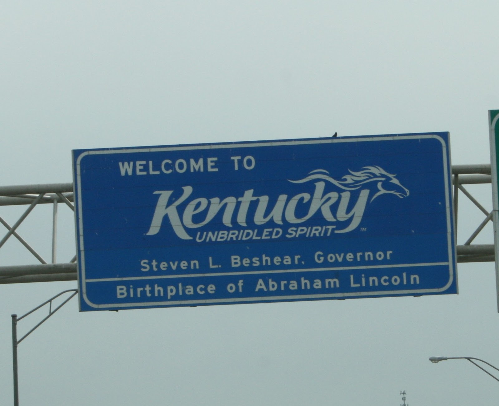
The first stop was at Abraham Lincoln Birthplace National Historical Park in Hodgenville, KY.  We entered a new time zone on the way.  We're now on central or "slow" time as some call it.  We call it fun time today because our beautiful day got to last 1 hour longer.

Memorial Building
The 56 marble steps are for each year of Abe's life
Symbolic log home from same period as Lincoln's birth
Sinking Spring entrance
(water source for the Lincoln's Sinking Spring farm)

We then drove a short distance to Horse Cave, KY and set-up at a KOA campground.  It's OK, but our site is far from level and we're right next to a barnyard with two ponies, a donkey, chickens, a rooster and a turkey.  
We should have asked if their great rates were "on the level"

The birds run free.  It looks like tomorrow morning is going to be really interesting at our house.

Next we drove south to Mammoth Cave National Park to check on tours.  The place was packed and tours were sold out for the day.  We got tickets for the Historic Tour tomorrow.

We finished the day by driving to Bowling Green, KY for shopping at Wal-Mart and Camping World.  We returned to the campground around 7:30pm (slow time).

April 4, 2013

Day 1 - Elizabethtown, KY

It took a while to finish getting ready today.  

Dick was at the Chevy service department by 8am.  The dealer had to finish a transmission repair they started on Monday.  The car was ready by 10, we finished packing by 11, loading and hook-up by noon and were finally on the road.

256 miles later we stopped at Elizabethtown Crossroads Campground.  The route: I-270 to I-71, I-71S to I-264 at Louisville, I-264 to I-65, I-65S to US-62 at Elizabethtown.

The day was overcast, calm and reached a high of 54°F.  The drive was uneventful except for sighting our first spring blooms as we approached Louisville.

Crossing the Ohio River from Cincinnati

Sometimes we cross our earlier travel routes.  We stayed at a different campground in Elizabethtown on May 3, 2011 at the start of our Southeastern Trip.

We were set-up at this campground by 7pm then finished de-winterizing the trailer.  This is the one time of the year when we have to re-learn tasks that were automatic the previous year.  Oh, well!

The campground is convenient.  The facilities are clean, but dated.  It used to be a KOA campground.
Sunset from Site #23

We're planning to visit Lincoln's Birthplace tomorrow.